Showing posts with label sea. Show all posts

Tuesday, 7 July 2026

TRAVEL TUESDAY 557 - LORD HOWE ISLAND, AUSTRALIA

“I thought to live on an island was like living on a boat. Islands intrigue me. You can see the perimeters of your world. It's a microcosm.” - Jamie Wyeth

Welcome to the Travel Tuesday meme! Join me every Tuesday and showcase your creativity in photography, painting and drawing, music, poetry, creative writing or a plain old natter about Travel.
There is only one simple rule: Link your own creative work about some aspect of travel and then share it with the rest of us. Please use this meme for your creative endeavours only.
Do not use this meme to advertise your products or services as any links or comments by advertisers will be removed immediately.

Located 780 km northeast of Sydney, Lord Howe Island is a UNESCO World Heritage-listed paradise. It limits tourist numbers to 400 at any one time to preserve its pristine environment. Accessible via a 2-hour flight from Sydney, the island is famous for its beaches, the world’s southernmost coral reef, and hiking trails.
Getting to the island is entirely by air. QantasLink offers daily, year-round flights from Sydney (under 2 hours). Additionally, Eastern Air Services operates flights and charters departing from Port Macquarie, the Gold Coast, and Newcastle. Once you arrive, there are no private cars, and most of the terrain is pedestrian-friendly. The primary mode of transportation is hiring bicycles or walking.
Because the island is relatively small (about 10 km long), everything is easily accessible. The best time to travel there is during the shoulder seasons—September to November and March to May. These months offer the perfect balance of warm, pleasant weather (averaging 20˚C to 22˚C) for hiking, while the ocean remains warm enough for swimming and snorkeling.
Home to more than 130 species of birds, it is a haven for birders. Highlights include seeing red-tailed tropicbirds performing courting rituals near the Malabar cliffs and watching countless shearwaters return at dusk. The trek up the towering Mount Gower is world-famous, offering breathtaking views of the subtropical landscape. You can drop into the Lord Howe Island Museum to learn about the region's unique biodiversity, history, and scientific specimens

You are invited to the Inlinkz link party!

Click here to enter

Thursday, 4 December 2025

BLOW, WIND...

“The man who has experienced shipwreck shudders even at a calm sea.” -  Ovid

Poets and Storytellers this week invites us to find inspiration in the titles of Florence + The Machine’s latest album, 'Everybody Scream'. I was not aware of this group’s music until I read the prompt and I had to go and listen to a few songs. Even though theirs is not a genre that I am particularly fond of, the setting of some of the video clips was particularly inspiring. And Love of course is always a good prompt. The wild Northern landscapes inspired my poem as a folk song, and it is set as such in my appended song…

Blow Wind…

Blow, wind, blow gently
Sweet zephyr, blow…

My fairest love is far away,
And far from her I have to stay;
I long for her caresses
The perfume of her tresses…

Her eyes wide open smiling
Her ruby lips beguiling;
I long to have her in my arms,
Surrender to her charms…

Blow, wind, blow tender breezes
Caress her as she pleases;
Shine sun, and gentle moon,
And give to her my boon:
My earnest kiss so sweet
Tell her that soon we’ll meet.

My fairest love is sleeping,
And in her dreams is keeping
Our sacred, solemn troth
Embroidered on rich cloth.

Her breast is gently heaving
In sleep she is believing,
That soon we’ll be together
Despite the raging weather.

Stop, wind, stop storm and gale
My ship do not assail,
Rain, woeful waterspout,
My ship don’t knock about;
My love is dreaming, waiting,
This storm need be abating.

Wind, why do you blow so wild?
Why have you sea defiled?
Why waves so high you raise,
Why do my craft you raze?
In the blue ocean depth,
Tell her I love, even in death.

The poem is set to music, and you can find all my music in my “Otidorchestre” channel or listen to it on YouTube, Spotify,  Amazon, Deezer, Flo, Pandora, and other music sharing sites.
Please note that there is delay between my uploading the music and your being able to access it. YouTube is generally the fastest to release the song.

Tuesday, 16 September 2025

TRAVEL TUESDAY 515 - GALAXEIDI, GREECE

“On a summer night, I have sat on the balcony drinking Ouzo, watching the ghosts of Greek Heroes sailing past, listening to the rustle of their sail cloths and the gentle lapping of their oars.” – Phil Simpkin

Welcome to the Travel Tuesday meme! Join me every Tuesday and showcase your creativity in photography, painting and drawing, music, poetry, creative writing or a plain old natter about Travel.
There is only one simple rule: Link your own creative work about some aspect of travel and share it with the rest of us.
Please use this meme for your creative endeavours only.Do not use this meme to advertise your products or services as any links or comments by advertisers will be removed immediately.
Galaxidi or Galaxeidi (Greek: Γαλαξίδι/Γαλαξείδι), is a town and a former municipality in the southern part of Phocis, Greece. Since the 2011 local government reform it is part of the municipality Delphi, of which it is a municipal unit. The municipal unit has an area of 126.088 km2. Galaxidi has a small harbour on the north coast of the Gulf of Corinth. It is 7 km southwest of Itea, 15 km southwest of Delphi, 17 km south of Amfissa and 48 km east of Naupactus. The Greek National Road 48 connects Galaxidi with Naupactus, Itea and Delphi. Galaxidi is a 2.5 to 3 hour drive from the capital Athens and a relatively popular weekend retreat.

Modern Galaxidi is built on the site of ancient Haleion, a city of western Locris. Traces of habitation are discernible since prehistoric times with a peak in the Early Helladic Period (Anemokambi, Pelekaris, Kefalari, islet of Apsifia). A significant Mycenaean settlement has been located at Villa; the hill of St. Athanasios also revealed a fortified Geometric settlement (ca. 700 BC). In the Archaic and Classical periods (7th-4th centuries BC) was developed the administrative and religious centre at the modern site of Agios Vlasis. It seems that in ca. 300 BC the present site was settled and surrounded by a fortification wall; it is the period of the expansion of power of the Aetolian League. Haleion flourished throughout the Hellenistic and Roman periods until the 2nd century AD.

Galaxidi is a small port situated on a natural double harbour surrounded by mountains. The deeper main harbour provides docking facilities for yachts and small fishing boats and is lined with restaurants, bars, and stores. The smaller harbour is Chirolaka. On the rocky shoreline by the side of the larger harbour, is a pine forest planted by school children in the early twentieth century. There is a road behind the town that leads up the mountain to the Monastery of the Metamorphosis (actually a convent that was inhabited by one nun as of 2010). This provides a splendid view of the town and its surroundings. No traces remain of the town's medieval castle. The Church of Saint John of Jerusalem, built by the Hospitallers in 1404, survived until after World War I, when it was replaced by a modern church dedicated to Saint Nicholas

You are invited to the Inlinkz link party!

Click here to enter

Tuesday, 20 May 2025

TRAVEL TUESDAY 497 - ASOS, CEPHALONIA, GREECE

“The sea was sapphire coloured, and the sky burned like a heated opal through the air; we hoisted sail; the wind was blowing fair for the blue lands that to the eastward lie.” - Oscar Wilde


Welcome to the Travel Tuesday meme! Join me every Tuesday and showcase your creativity in photography, painting and drawing, music, poetry, creative writing or a plain old natter about Travel.

There is only one simple rule: Link your own creative work about some aspect of travel and share it with the rest of us. Please use this meme for your creative endeavours only.

Do not use this meme to advertise your products or services as any links or comments by advertisers will be removed immediately.

Asos (Greek: Άσος) is a village on the west coast of the island of Cephalonia, Greece and is located 36km north of Argostoli, the capital. It is part of the municipal unit Erisos. Asos was founded under Venetian rule and it served as the administrative capital of northern Cephalonia from 1593 onwards.

Marino Gentilini, an Italian army engineer, was commissioned by the Venetian Senate in 1593-1595 to build the Asos Castle, one of the largest in Greece. The castle was initially built with the view that it would protect local populations in case of an invading attack by passing Turks or pirates, but for various reasons, such as the lack of natural springs for water supply, it was never adopted as a fortress and gradually the grand plan was dropped

.

Nowadays, Asos is a picturesque fishing village that looks out onto the Ionian Sea and is full of colourful houses and narrow alleyways lined with bougainvilleas. Here, you can take a refreshing dip at Asos Beach, try local Greek cuisine at a waterfront cafe, and even hike up the Frourio Peninsula to see the remains of the  16th-century Venetian Castle. The lookout also offers stunning views of the turquoise waters and bluffs along Cephalonia’s north coast. The drive to Asos will take you down a steep and winding road. You can opt for a guided tour which often also includes stops at Drogarati Cave and Melissani Lake.

You are invited to the Inlinkz link party!

Click here to enter

Tuesday, 18 February 2025

TRAVEL TUESDAY 484 - PORT LOUIS, MAURITIUS

“Mauritius was made first and then heaven, heaven being copied after Mauritius.” - Mark Twain

Welcome to the Travel Tuesday meme! Join me every Tuesday and showcase your creativity in photography, painting and drawing, music, poetry, creative writing or a plain old natter about Travel.

There is only one simple rule: Link your own creative work about some aspect of travel and share it with the rest of us. Please use this meme for your creative endeavours only.

Do not use this meme to advertise your products or services as any links or comments by advertisers will be removed immediately.

Mauritius, officially the Republic of Mauritius, is an island country in the Indian Ocean, about 2,000 kilometres off the southeastern coast of East Africa, east of Madagascar. It includes the main island (also called Mauritius), as well as Rodrigues, Agaléga, and St. Brandon (Cargados Carajos shoals). The islands of Mauritius and Rodrigues, along with nearby Réunion (a French overseas department), are part of the Mascarene Islands. The main island of Mauritius, where the population is concentrated, hosts the capital and largest city, Port Louis (see photo). The country spans 2,040 square kilometres and has an exclusive economic zone covering 2,300,000 square kilometres.

Given its geographic location and colonial past, the people of Mauritius are diverse in ethnicity, culture, language and faith. It is the only country in Africa where Hinduism is the most practised religion. Indo-Mauritians make up the bulk of the population with significant Creole, Sino-Mauritian and Franco-Mauritian minorities. The island's government is closely modelled on the Westminster parliamentary system with Mauritius highly ranked for economic and political freedom. The Economist Democracy Index ranks Mauritius as the only country in Africa with full democracy.

Mauritius ranks 72nd (high) in the Human Development Index and the World Bank classifies it as a high-income economy. It is amongst the most competitive and most developed economies in the African region. The country is a welfare state. The government provides free universal health care, free education up through the tertiary level, and free public transportation for students, senior citizens, and the disabled. Mauritius is consistently ranked as the most peaceful country in Africa.

You are invited to the Inlinkz link party!

Click here to enter

Tuesday, 24 September 2024

TRAVEL TUESDAY 463 - CAPE COD, USA

"Inside my empty bottle I was constructing a lighthouse while all the others were making ships." -  Charles Simic


Welcome to the Travel Tuesday meme! Join me every Tuesday and showcase your creativity in photography, painting and drawing, music, poetry, creative writing or a plain old natter about Travel.

There is only one simple rule: Link your own creative work about some aspect of travel and share it with the rest of us.

Please use this meme for your creative endeavours only. Do not use this meme to advertise your products or services as any links or comments by advertisers will be removed immediately.

Cape Cod is a peninsula extending into the Atlantic Ocean from the southeastern corner of Massachusetts, in the northeastern United States. Its historic, maritime character and ample beaches attract heavy tourism during the summer months. The name Cape Cod, coined in 1602 by Bartholomew Gosnold, is the ninth oldest English place-name in the U.S.
As defined by the Cape Cod Commission's enabling legislation, Cape Cod is coextensive with Barnstable County, Massachusetts. It extends from Provincetown in the northeast to Woods Hole in the southwest, and is bordered by Plymouth to the northwest. The Cape is divided into fifteen towns, several of which are in turn made up of multiple named villages. Cape Cod forms the southern boundary of the Gulf of Maine, which extends north-eastward to Nova Scotia.

Beginning in 1797, lighthouses were erected along Cape Cod to aid in navigation. Highland Light (or Cape Cod Light) is the oldest and tallest of these, and remains as one of a number of working lighthouses on Cape Cod and the Islands. Many of Cape Cod's earliest lighthouses featured a light tower that was attached directly to, and centred on the roof of the keeper's dwelling. A stairway to the lantern room was accessible only from the top floor of the house. This came to be known as a Cape Cod style lighthouse, yet today, the only fully intact specimens are on the west coast of the United States.

You are invited to the Inlinkz link party!

Click here to enter

Tuesday, 12 March 2024

TRAVEL TUESDAY 435 - FREMANTLE, WESTERN AUSTRALIA

“The fishermen know that the sea is dangerous and the storm terrible, but they have never found these dangers sufficient reason for remaining ashore.” - Vincent Van Gogh

Welcome to the Travel Tuesday meme! Join me every Tuesday and showcase your creativity in photography, painting and drawing, music, poetry, creative writing or a plain old natter about Travel.
There is only one simple rule: Link your own creative work about some aspect of travel and share it with the rest of us.
Please use this meme for your creative endeavours only. Do not use this meme to advertise your products or services as any links or comments by advertisers will be removed immediately.
Fremantle Fishing Boat Harbour is a commercial marina in Fremantle, Western Australia, adjacent to the more recently constructed Challenger Harbour. It provides large sheltered mooring areas, wharf space for vessels up to 60 metres, refuelling facilities and support services to the Fremantle fishing industry. The harbour was built in 1919 when a 300-metre breakwater was constructed to provide an anchorage for fishing vessels. South Jetty was immediately adjacent and included a fish market which was removed in 1929.
A southern breakwater was constructed in 1962 and land reclaimed to house fishing companies and service industries. Between 1969 and 1972, up to 120 fishing boats were housed in the harbour and in 1982, construction of a boat lifting facility commenced. Fremantle Fishing Boat Harbour is now surrounded by a well established tourism precinct, and over a dozen restaurants and a brewery are immediately adjacent.
Western Australia`s early fishermen worked hard and often in dangerous conditions. They helped create an internationally respected modern industry and gave Fremantle much of its character and charm. There are two life-size bronze sculptures of fishermen, a map of the coastline showing traditional fishing grounds and a short history on the industry`s history. Twelve timber columns on the jetty carry the names of the 608 fishermen who pioneered the industry at Fremantle.

You are invited to the Inlinkz link party!

Click here to enter

Tuesday, 23 January 2024

TRAVEL TUESDAY 428 - NISYROS, GREECE


“For the wise is easy to go anywhere. Because the whole world is home for a good soul.” – Democritus

Welcome to the Travel Tuesday meme! Join me every Tuesday and showcase your creativity in photography, painting and drawing, music, poetry, creative writing or a plain old natter about Travel.
There is only one simple rule: Link your own creative work about some aspect of travel and share it with the rest of us.
Please use this meme for your creative endeavours only. Do not use this meme to advertise your products or services as any links or comments by advertisers will be removed immediately.
Nisyros (Greek: Νίσυρος) is a volcanic Greek island and municipality located in the Aegean Sea. It is part of the Dodecanese group of islands, situated between the islands of Kos and Tilos. Its shape is approximately round, with a diameter of about 8 km, and an area of 41.6 km2. Several other islets are found in the direct vicinity of Nisyros, the largest of which is Gyali.

The Municipality of Nisyros includes Gyalí (pop. 21) as well as uninhabited Pacheiá, Pergoússa, Kandelioússa, Ágios Antónios and Stroggýli. It has a total land area of 50.055 km2 and a total population of 1,008 inhabitants. The island was also called Nisiro in Italian and İncirli in Turkish. The island has a 3-4 kilometre wide caldera, and was formed within the past 150,000 years, with 3 separate eruptive stages, ranging from explosive and effusive andesitic eruptions to effusive and extrusive dacitic and rhyolitic activity.

The coasts of Nisyros are generally rocky or pebbled, but there are also a few sandy beaches (mainly in the northeastern part). The volcano is currently active (but not erupting), and fumaroles are found in the craters.

You are invited to the Inlinkz link party!

Click here to enter

Tuesday, 16 January 2024

TRAVEL TUESDAY 427 - SYDNEY, AUSTRALIA

“One of the great things about Sydney is that it has a great acceptance of everyone and everything. It's an incredibly tolerant city, a city with a huge multicultural basis.” - Baz Luhrmann

Welcome to the Travel Tuesday meme! Join me every Tuesday and showcase your creativity in photography, painting and drawing, music, poetry, creative writing or a plain old natter about Travel.
There is only one simple rule: Link your own creative work about some aspect of travel and share it with the rest of us.
Please use this meme for your creative endeavours only. Do not use this meme to advertise your products or services as any links or comments by advertisers will be removed immediately.

Sydney is known as the Harbour City and with good reason as it is built around a magnificent natural harbour. It is the largest, oldest and most cosmopolitan city in Australia with an enviable reputation as one of the world’s most beautiful cities. It is full of history, culture, art, fashion, cuisine, design and within the city or a short distance from it are areas of great natural beauty, The city is set next to kilometres of ocean coastline and sandy surf beaches. Recent immigration trends have led to the city’s reputation as one of the most culturally and ethnically diverse cities in Australia and the world. The city is also home to the Sydney Opera House and the Sydney Harbour Bridge, two of the most iconic structures on the planet.

The Greater Sydney area is a vast sprawling metropolitan area with the suburbs spreading up to 100km from the city centre. The traveller visiting the suburbs will find less crowded beaches, parks, cheaper shopping, commercial centres, cultural festivals, and hidden gems. The Eastern Suburbs are between the City and the sea, and include the world-famous Bondi Beach and other city beaches, which are strong drawcards for visitors and residents in the city during summer.   The City Centre is the busy centre of government and finance, but also home to many famous attractions, fine restaurants, and shopping. Just to the west of Circular Quay, is the Rocks, the first colonial village of Sydney and the iconic Harbour Bridge, which are now a cosmopolitan and touristic area.

Immediately to the west of the CBD is Darling Harbour, an extensive leisure and entertainment area. You can see restaurants, boardwalks, aquariums, wildlife, and museums by foot or with the public transport. In the City South district is the Haymarket, Chinatown and Central Station, being an area home to markets, cafes, Chinese culture and cuisine, and some cheaper accommodation and shopping. In the City East region, are Kings Cross, Darlinghurst, Surry Hills, Woolloomooloo and Moore Park. It’s here where you can sample the busy nightlife, trendy coffee shops, fashion and entertainment. The City West area is best seen in early morning, with a trip to the bustling fish markets, and then exploring the Powerhouse Museum, finding a maritime pub or visiting the Casino.

You are invited to the Inlinkz link party!

Click here to enter

Tuesday, 26 December 2023

TRAVEL TUESDAY 424 - CRETE GREECE

“There is a kind of flame in Crete - let us call it ‘soul’ - something more powerful than either life or death. There is pride, obstinacy, valour, and together with these something else inexpressible and imponderable, something which makes you rejoice that you are a human being, and at the same time tremble.” ― Nikos Kazantzakis

Welcome to the Travel Tuesday meme! Join me every Tuesday and showcase your creativity in photography, painting and drawing, music, poetry, creative writing or a plain old natter about Travel.
There is only one simple rule: Link your own creative work about some aspect of travel and share it with the rest of us.
Please use this meme for your creative endeavours only. Do not use this meme to advertise your products or services as any links or comments by advertisers will be removed immediately.
Crete (Greek: Κρήτη, Modern: Kríti [ˈkriti], Ancient: Krḗtē [krɛ̌ːtεː]) is the largest and most populous of the Greek islands, the 88th largest island in the world and the fifth largest island in the Mediterranean Sea, after Sicily, Sardinia, Cyprus, and Corsica. Crete rests about 160 km south of the Greek mainland, and about 100 km southwest of Anatolia. Crete has an area of 8,450 km2 and a coastline of 1,046 km. It bounds the southern border of the Aegean Sea, with the Sea of Crete (or North Cretan Sea) to the north and the Libyan Sea (or South Cretan Sea) to the south. Crete covers 260 km from west to east but is narrow from north to south, spanning three longitudes but only half a latitude.

Crete and a number of islands and islets that surround it constitute the Region of Crete (Greek: Περιφέρεια Κρήτης), which is the southernmost of the 13 top-level administrative units of Greece, and the fifth most populous of Greece's regions. Its capital and largest city is Heraklion, on the north shore of the island. As of 2020, the region had a population of 636,504. The Dodecanese are located to the northeast of Crete, while the Cyclades are situated to the north, separated by the Sea of Crete. The Peloponnese is to the region's northwest.

Crete was the centre of Europe's first advanced civilization, the Minoans, from 2700 to 1420 BC. The Minoan civilization was overrun by the Mycenaean civilization from mainland Greece. Crete was later ruled by Rome, then successively by the Byzantine Empire, Andalusian Arabs, the Venetian Republic, and the Ottoman Empire. In 1898 Crete, whose people had for some time wanted to join the Greek state, achieved independence from the Ottomans, formally becoming the Cretan State. Crete became part of Greece in December 1913.

 The island is mostly mountainous, and its character is defined by a high mountain range crossing from west to east. It includes Crete's highest point, Mount Ida, and the range of the White Mountains (Lefka Ori) with 30 summits above 2,000 metres in altitude and the Samaria Gorge, a World Biosphere Reserve. Crete forms a significant part of the economy and cultural heritage of Greece, while retaining its own local cultural traits (such as its own poetry and music). The Nikos Kazantzakis airport at Heraklion and the Daskalogiannis airport at Chania serve international travellers. The Minoan palace at Knossos is also located near Heraklion.

You are invited to the Inlinkz link party!

Click here to enter

Tuesday, 28 November 2023

TRAVEL TUESDAY 420 - MANI, GREECE

“To rejoice in life, to find the world beautiful and delightful to live in, was a mark of the Greek spirit which distinguished it from all that had gone before. It is a vital distinction.” - Edith Hamilton

Welcome to the Travel Tuesday meme! Join me every Tuesday and showcase your creativity in photography, painting and drawing, music, poetry, creative writing or a plain old natter about Travel.
There is only one simple rule: Link your own creative work about some aspect of travel and share it with the rest of us.
Please use this meme for your creative endeavours only. Do not use this meme to advertise your products or services as any links or comments by advertisers will be removed immediately.
Mani is a region in the southwestern part of the Peloponnese, Greece. It is an area of wild and unspoilt natural beauty, rich traditions, and great history. It is not as well-known as other parts of Greece, and hence still not very touristic, although there are some wonderful amenities and infrastructure to please even the most demanding visitors who find their way there. The people of Mani are hospitable, generous and welcoming.

You are invited to the Inlinkz link party!

Click here to enter

Tuesday, 14 November 2023

TRAVEL TUESDAY 418 - HERAKLION, CRETE, GREECE

“I wonder if Socrates and Plato took a house on Crete during the summer.” - Woody Allen

Welcome to the Travel Tuesday meme! Join me every Tuesday and showcase your creativity in photography, painting and drawing, music, poetry, creative writing or a plain old natter about Travel.
There is only one simple rule: Link your own creative work about some aspect of travel and share it with the rest of us.
Please use this meme for your creative endeavours only. Do not use this meme to advertise your products or services as any links or comments by advertisers will be removed immediately.
Heraklion (Greek: Ηράκλειο, Irákleio) is the largest city and the administrative capital of the island of Crete. It is the fourth largest city in Greece. According to the results of the 2011 census, the population of the city proper was 140,730 inhabitants, the municipality's was 173,993 while the Heraklion urban area has a population of 225,574 and it extends over an area of 684.3 km2.
Heraklion is the capital of Heraklion regional unit. The Bronze Age palace of Knossos, also known as the Palace of Minos, is located nearby. The city is an eclectic mixture of Ancient Greek, Roman, Arab, Byzantine and modern-day buildings, ruins, architecture and significant history. An excellent museum in the city has a host of amazing artifacts of nearly 4,000 years of history.

You are invited to the Inlinkz link party!

Click here to enter

Tuesday, 31 October 2023

TRAVEL TUESDAY 416 - TWELVE APOSTLES, AUSTRALIA

“Even the Australians don’t know how beautiful their own country is.” – Brian Cox

Welcome to the Travel Tuesday meme! Join me every Tuesday and showcase your creativity in photography, painting and drawing, music, poetry, creative writing or a plain old natter about Travel.
There is only one simple rule: Link your own creative work about some aspect of travel and share it with the rest of us.
Please use this meme for your creative endeavours only.  Do not use this meme to advertise your products or services as any links or comments by advertisers will be removed immediately.
The Great Ocean Road is an Australian National Heritage listed 243-kilometre stretch of road along the south-eastern coast of Australia between the Victorian cities of Torquay and Warrnambool. The road was built by returned soldiers between 1919 and 1932, and is the world's largest war memorial; dedicated to casualties of World War I. It is an important tourist attraction in the region, which winds through varying terrain alongside the coast, and provides access to several prominent landmarks; including the nationally significant Twelve Apostles rock formations. 

The Twelve Apostles is a collection of miocene limestone rock stacks jutting from the water in Port Campbell National Park, between Princetown and Peterborough on the Great Ocean Road. The apostles were formed by erosion: The harsh weather conditions from the Southern Ocean gradually eroded the soft limestone to form caves in the cliffs, which then became arches, which in turn collapsed; leaving rock stacks up to 45 metres high. The site was known as the Sow and Piglets until 1922 (Muttonbird Island, near Loch Ard Gorge, was the Sow, and the smaller rock stacks the Piglets); after which it was renamed to The Apostles for tourism purposes. The formation eventually became known as the Twelve Apostles, despite only ever having nine stacks.

You are invited to the Inlinkz link party!

Click here to enter

Tuesday, 8 August 2023

TRAVEL TUESDAY 403 - CAPRI, ITALY

“There was a magical timelessness to Capri A special atmosphere, and a sense of history.” ― Kitty Pilgrim

Welcome to the Travel Tuesday meme! Join me every Tuesday and showcase your creativity in photography, painting and drawing, music, poetry, creative writing or a plain old natter about Travel.
There is only one simple rule: Link your own creative work about some aspect of travel and share it with the rest of us. Please use this meme for your creative endeavours only.
Do not use this meme to advertise your products or services as any links or comments by advertisers will be removed immediately.
Capri is an island located in the Tyrrhenian Sea off the Sorrentine Peninsula, on the south side of the Gulf of Naples in the Campania region of Italy. The main town Capri that is located on the island shares the name and is the largest population centre. The island has two harbours, Marina Piccola and Marina Grande (the main port of the island). The separate comune of Anacapri is located high on the hills to the west.
Capri has been a resort since the time of the Roman Republic. Some of the main features of the island include the following: the Marina Piccola (the little harbour), the Belvedere of Tragara (a high panoramic promenade lined with villas), the limestone crags called sea stacks that project above the sea (the Faraglioni), the town of Anacapri, the Blue Grotto (Grotta Azzurra), and the ruins of the Imperial Roman villas.

You are invited to the Inlinkz link party!

Click here to enter

Tuesday, 18 July 2023

TRAVEL TUESDAY 400 - FIJI

“Love is like an ocean, you never truly know the depth of it until you’re really in it.” – Fijian Proverb

Welcome to the Travel Tuesday meme! Join me every Tuesday and showcase your creativity in photography, painting and drawing, music, poetry, creative writing or a plain old natter about Travel.
There is only one simple rule: Link your own creative work about some aspect of travel and share it with the rest of us. Please use this meme for your creative endeavours only.
Do not use this meme to advertise your products or services as any links or comments by advertisers will be removed immediately.
Fiji (Fijian: Viti), officially the Republic of Fiji, is an island country in Melanesia, part of Oceania in the South Pacific Ocean. It lies about 2,000 km north-northeast of New Zealand. Fiji consists of an archipelago of more than 330 islands (of which about 110 are permanently inhabited) and more than 500 islets, amounting to a total land area of about 18,300 square kilometres.

The most outlying island group is Ono-i-Lau. About 87% of the total population of 924,610 live on the two major islands, Viti Levu and Vanua Levu. About three-quarters of Fijians live on Viti Levu's coasts: either in the capital city of Suva; or in smaller urban centres such as Nadi, where tourism is the major local industry; or in Lautoka, where the sugar-cane industry is dominant. The interior of Viti Levu is sparsely inhabited because of its terrain.

Fiji has one of the most developed economies in the Pacific through its abundant forest, mineral, and fish resources. The currency is the Fijian dollar, with the main sources of foreign exchange being the tourist industry, remittances from Fijians working abroad, bottled water exports, and sugar cane. The Ministry of Local Government and Urban Development supervises Fiji's local government, which takes the form of city and town councils.

Add your own travel posts using the Linky tool below, and don't forget to be nice and leave a comment here, and link back to this page from your own post.

You are invited to the Inlinkz link party!

Click here to enter

Tuesday, 6 June 2023

TRAVEL TUESDAY 394 - LIMENI, GREECE

“Every rock and stream is a myth.” ― Patrick Leigh Fermor, Mani: Travels in the Southern Peloponnese

Welcome to the Travel Tuesday meme! Join me every Tuesday and showcase your creativity in photography, painting and drawing, music, poetry, creative writing or a plain old natter about Travel.
There is only one simple rule: Link your own creative work about some aspect of travel and share it with the rest of us.
Please use this meme for your creative endeavours only. Do not use this meme to advertise your products or services as any links or comments by advertisers will be removed immediately.
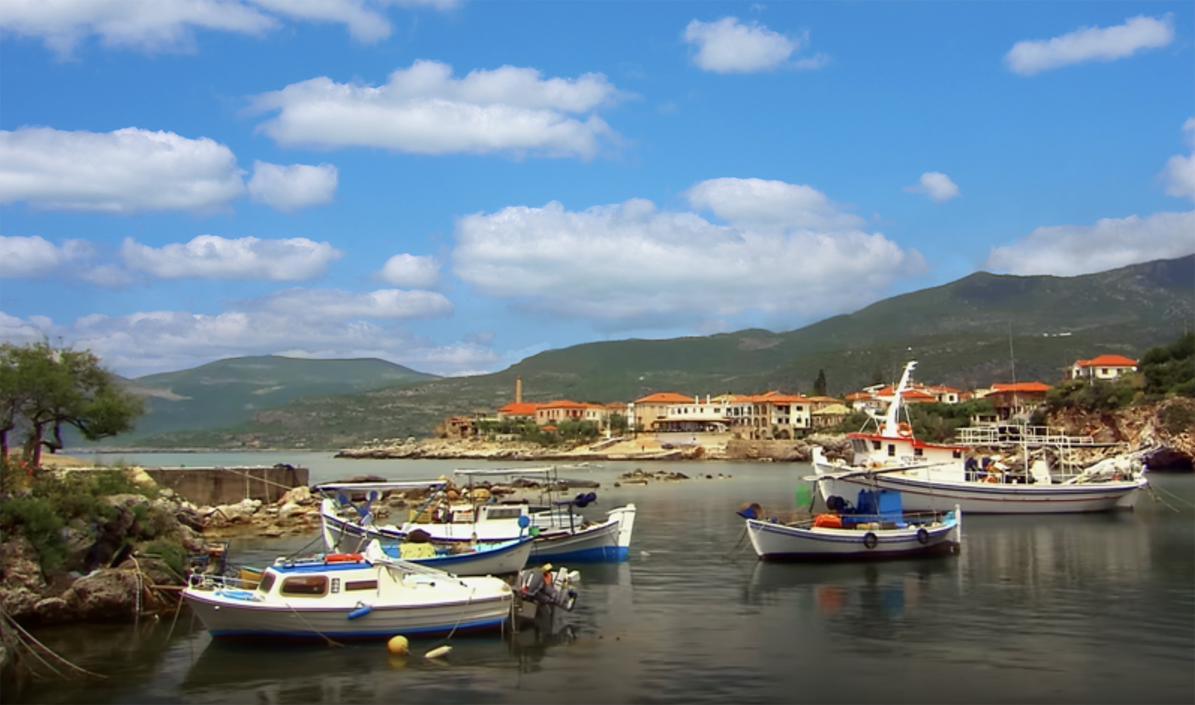
Limeni is a village in Mani, a region in the southwestern part of the Peloponnese. It is an area of wild and unspoilt natural beauty, rich traditions, and great history. It is not as well-known as other parts of Greece, and hence still not very touristic, although there are some wonderful amenities and infrastructure to please even the most demanding visitor.

Limeni is one of the most beautiful coastal villages in Mani and is located three km north of the capital Areopoli. Although it is by no means a beach resort, the crystal clear turquoise waters are perfect for swimming in and for water activities. Several tavernas and restaurants serve deliciously fresh seafood and other wonderful. Traditional Greek dishes. There are comfortable accommodation options too.

You are invited to the Inlinkz link party!

Click here to enter

Tuesday, 18 April 2023

TRAVEL TUESDAY 387 - PAXOI ISLANDS, GREECE

“How sweet it is to view the sea while standing on the shore.” – Greek Proverb 
Welcome to the Travel Tuesday meme! Join me every Tuesday and showcase your creativity in photography, painting and drawing, music, poetry, creative writing or a plain old natter about Travel.
There is only one simple rule: Link your own creative work about some aspect of travel and share it with the rest of us. Please use this meme for your creative endeavours only.
Do not use this meme to advertise your products or services as any links or comments by advertisers will be removed immediately.
Paxos (Greek: Παξός) is a Greek island in the Ionian Sea, lying just south of Corfu. As a group with the nearby island of Antipaxos and adjoining islets, it is also called by the plural form Paxi or Paxoi (Greek: Παξοί). The main town and the seat of the municipality is Gaios.
Paxos is the smallest of the seven main Ionian Islands (the Heptanese), with an area of 25.3 square kilometres, while the municipality has an area of 30.121 km2  and a population of about 2300. Paxos lies some 15 km from the southern tip of Corfu, and at about the same distance from the town of Parga on the mainland. It is connected by ferry lines from Igoumenitsa and Corfu with Gaios. The island is hilly, the highest point having an elevation of 230 m. 
In Greek mythology, the god of the sea Poseidon created the island by striking Corfu with his trident, so that he and his wife Amphitrite could have some peace and quiet on these smaller islands, when they left the depths of the sea for a sojourn on dry land.

You are invited to the Inlinkz link party!

Click here to enter

Tuesday, 14 March 2023

TRAVEL TUESDAY 382 - KARDAMILI, GREECE

“Every rock and stream is a myth.” ― Patrick Leigh Fermor

Welcome to the Travel Tuesday meme! Join me every Tuesday and showcase your creativity in photography, painting and drawing, music, poetry, creative writing or a plain old natter about Travel.
There is only one simple rule: Link your own creative work about some aspect of travel and share it with the rest of us. Please use this meme for your creative endeavours only.
Do not use this meme to advertise your products or services as any links or comments by advertisers will be removed immediately.
Kardamili (Greek: Καρδαμύλη, variously transliterated as Kardamyle, Cardamyle, Kardhamili, and Kardamyli, and sometimes called "Skardamoula", especially on old maps) is a town by the sea thirty-five kilometres southeast of Kalamata, Greece. It is the seat of the municipality of Lefktro in the region of Messenia on the Mani Peninsula. In the Iliad (Book 9), Homer cites Kardamili as one of the seven cities offered by Agamemnon to Achilles as a condition to rejoin the fight during the Trojan War. The village preserves its ancient name.
The area is filled with beaches: Ritsa, Belogianni, Salio, Tikla, Amoni, Santava. The older town includes a mediaeval castle and outworks, and the imposing church of Saint Spyridon. Many of the buildings of Old Kardamili, also known as Pano Kardamili, or "Upper Kardamili" were built by the Venetians and feature a mix of traditional Greek and Venetian design. The skyline of Kardamyli, like many other Maniot towns and villages, is dominated by the distinctive regional architectural of the various towers built by scions of the Nikliani clans, the mediaeval aristocracy of the Mani.
Kardamili is the departure point of many mountain trails, some of which lead to the peak of Mount Taygetus. Kardamili is known in the area for having an especially good view of Mount Taygetus, known locally as Profitis Ilias, literally translating to "Prophet Elijah". Nearby is the Viros Gorge, with a total length of 20 km. The Viros Gorge remains bone dry in summer, however it is known to flood heavily in winter, when snow melts on the mountains and rain falls in heavy downpours. Further afield, one may visit the towns of Oitylo, Areopoli and the Diros caverns.

You are invited to the Inlinkz link party!

Click here to enter