Tuesday, 16 May 2023

TRAVEL TUESDAY 391 - KASTORIA, GREECE

“Perhaps the truth depends on a walk around the lake.” – Wallace Stevens

Welcome to the Travel Tuesday meme! Join me every Tuesday and showcase your creativity in photography, painting and drawing, music, poetry, creative writing or a plain old natter about Travel.
There is only one simple rule: Link your own creative work about some aspect of travel and share it with the rest of us.
Please use this meme for your creative endeavours only. Do not use this meme to advertise your products or services as any links or comments by advertisers will be removed immediately.
Kastoria (Greek: Καστοριά, Kastoriá) is a city in northern Greece in the region of Western Macedonia. It is the capital of the Kastoria regional unit, in the geographic region of Macedonia. It is situated on a promontory on the western shore of Lake Orestiada, in a valley surrounded by limestone mountains.
The town is known for its many Byzantine churches, Byzantine and Ottoman-era domestic architecture, its lake and its fur clothing industry. 
Lake Orestiada or Lake of Kastoria (Greek: Λίμνη Ορεστιάδα) is a lake in Kastoria. Sitting at an altitude of 630 metres, the lake covers an area of 28 square kilometres.  Nine rivulets flow into the lake, and it drains into the Haliacmon river. Its depth varies from nine to ten metres. The Kastoria Peninsula (with the town of Kastoria) divides the lake into two parts, the larger to the north and the smaller to the south.
The lake takes its name from the Oreiades (mountain nymphs). Lakeside attractions include, apart from the Byzantine architectural heritage of the town, an 11th-century Byzantine monastery of Panagia Mavriotissa and the reconstructed prehistoric settlement of Dispilio, where the Dispilio Tablet was retrieved from the lake in 1992. The lake is known to freeze in winters.

You are invited to the Inlinkz link party!

Click here to enter

Tuesday, 9 May 2023

TRAVEL TUESDAY 390 - VIENNA, AUSTRIA

“Vienna is a handsome, lively city, and pleases me exceedingly.” – Frederic Chopin

Welcome to the Travel Tuesday meme! Join me every Tuesday and showcase your creativity in photography, painting and drawing, music, poetry, creative writing or a plain old natter about Travel.
There is only one simple rule: Link your own creative work about some aspect of travel and share it with the rest of us. Please use this meme for your creative endeavours only.
Do not use this meme to advertise your products or services as any links or comments by advertisers will be removed immediately.
The Belvedere is a historic building complex in Vienna, Austria, consisting of two Baroque palaces (the Upper and Lower Belvedere), the Orangery, and the Palace Stables. The buildings are set in a Baroque park landscape in the third district of the city, on the south-eastern edge of its centre. It houses the Belvedere museum.
The grounds are set on a gentle gradient and include decorative tiered fountains and cascades, Baroque sculptures, and majestic wrought iron gates. The Baroque palace complex was built as a summer residence for Prince Eugene of Savoy.
The Belvedere was built during a period of extensive construction in Vienna, which at the time was both the imperial capital and home to the ruling Habsburg dynasty. This period of prosperity followed on from the commander-in-chief Prince Eugene of Savoy's successful conclusion of a series of wars against the Ottoman Empire.

You are invited to the Inlinkz link party!

Click here to enter

Tuesday, 2 May 2023

TRAVEL TUESDAY 389 - ŠOLTA ISLAND, CROATIA

“In a land of hate, those who refuse to hate are hated the most.” - Ivo Andrić (1892-1975)
Welcome to the Travel Tuesday meme! Join me every Tuesday and showcase your creativity in photography, painting and drawing, music, poetry, creative writing or a plain old natter about Travel.
There is only one simple rule: Link your own creative work about some aspect of travel and share it with the rest of us. Please use this meme for your creative endeavours only.
Do not use this meme to advertise your products or services as any links or comments by advertisers will be removed immediately.
Šolta (Latin: Solentium) is an island in Croatia. It is situated in the Adriatic Sea in the central Dalmatian archipelago, west of the island of Brač, south of Split (separated by Split Channel) and east of the Drvenik islands, Drvenik Mali and Drvenik Veli (separated by the Šolta Channel). The main settlement is Grohote. Its area is 58.98 km2. and as of 2011 it has a population of 1,700.
The highest peak of Šolta is the summit Vela Straža which is 236 metres high. On the north-eastern coast of the island there are the large bays of Rogač and Nečujam. In the western part of the interior of Šolta there is a field approximately 6 km  long and 2 km wide.
The economy of the island is based on vineyards, olives, fruit, fishing and tourism. While the main settlements (Grohote, Gornje Selo, Srednje Selo, Donje Selo) are inland, the main fishing centres are Maslinica, which is exposed to only north-westerly winds, making it a good shelter for smaller boats. Rogač is the main port and Nečujam the centre of the island's tourism.

You are invited to the Inlinkz link party!

Click here to enter

Tuesday, 25 April 2023

TRAVEL TUESDAY 388 - HIERAPOLIS, TURKIYE

“The theatre, our theatre, comes from the Greeks.” - Edward Bond

Welcome to the Travel Tuesday meme! Join me every Tuesday and showcase your creativity in photography, painting and drawing, music, poetry, creative writing or a plain old natter about Travel.

There is only one simple rule: Link your own creative work about some aspect of travel and share it with the rest of us. Please use this meme for your creative endeavours only.

Do not use this meme to advertise your products or services as any links or comments by advertisers will be removed immediately.

Hierapolis (Ancient Greek: Ἱεράπολις, lit. "Holy City") was originally a Phrygian cult centre of the Anatolian mother goddess of Cybele and later a Greek city. Its location was centred upon the remarkable and copious hot springs in classical Phrygia in southwestern Anatolia.

Its extensive remains are adjacent to modern Pamukkale in Turkey. The hot springs have been used as a spa since at least the 2nd century BC, with many patrons retiring or dying there as evidenced by the large necropolis filled with tombs, most famously that of Marcus Aurelius Ammianos, which bears a relief depicting the earliest known example of a crank and rod mechanism, and the Tomb of Philip the Apostle.

It was added as a UNESCO World Heritage Site in 1988. In the archaeological site operates since 1957 the "Italian Archaeological Mission of Hierapolis of Frigia" (MAIER), currently directed by Grazia Semeraro, Professor of Classical Archaeology of the University of Salento.

The Roman Theatre (photo above) was probably constructed under the reign of Hadrian after the earthquake of 60 AD. The façade is 91 m long, the full extent of which remains standing. In the cavea there are 50 rows of seats divided into seven parts by eight intermediate stairways. The diazoma, which divided the cavea into two, was entered by two vaulted passages (the vomitoria). There is an Imperial loge at the middle of the cavea and a 6-foot-high (1.83 m) wall surrounding the orchestra.

An earthquake in Hierapolis in the 7th century caused the collapse of the entire building as well as the ultimate abandonment of the city. Since the 18th century, the monument's striking ruins have become a recurrent theme in European travellers’ descriptions and engravings. The theatre has been the object of important restorations between 2004 and 2014.

 You are invited to the Inlinkz link party!

Tuesday, 18 April 2023

TRAVEL TUESDAY 387 - PAXOI ISLANDS, GREECE

“How sweet it is to view the sea while standing on the shore.” – Greek Proverb 
Welcome to the Travel Tuesday meme! Join me every Tuesday and showcase your creativity in photography, painting and drawing, music, poetry, creative writing or a plain old natter about Travel.
There is only one simple rule: Link your own creative work about some aspect of travel and share it with the rest of us. Please use this meme for your creative endeavours only.
Do not use this meme to advertise your products or services as any links or comments by advertisers will be removed immediately.
Paxos (Greek: Παξός) is a Greek island in the Ionian Sea, lying just south of Corfu. As a group with the nearby island of Antipaxos and adjoining islets, it is also called by the plural form Paxi or Paxoi (Greek: Παξοί). The main town and the seat of the municipality is Gaios.
Paxos is the smallest of the seven main Ionian Islands (the Heptanese), with an area of 25.3 square kilometres, while the municipality has an area of 30.121 km2  and a population of about 2300. Paxos lies some 15 km from the southern tip of Corfu, and at about the same distance from the town of Parga on the mainland. It is connected by ferry lines from Igoumenitsa and Corfu with Gaios. The island is hilly, the highest point having an elevation of 230 m. 
In Greek mythology, the god of the sea Poseidon created the island by striking Corfu with his trident, so that he and his wife Amphitrite could have some peace and quiet on these smaller islands, when they left the depths of the sea for a sojourn on dry land.

You are invited to the Inlinkz link party!

Click here to enter

Tuesday, 11 April 2023

TRAVEL TUESDAY 386 - RONDA, SPAIN

“There is no nightlife in Spain. They stay up late but they get up late. That is not nightlife. That is delaying the day.” – Ernest Hemingway
Welcome to the Travel Tuesday meme! Join me every Tuesday and showcase your creativity in photography, painting and drawing, music, poetry, creative writing or a plain old natter about Travel. There is only one simple rule: Link your own creative work about some aspect of travel and share it with the rest of us. Please use this meme for your creative endeavours only. Do not use this meme to advertise your products or services as any links or comments by advertisers will be removed immediately.
Ronda is a town in the Spanish province of Málaga. It is located about 105 km west of the city of Málaga, within the autonomous community of Andalusia. Its population is about 35,000. Ronda is known for its cliffside location and a deep canyon that carries the Guadalevín River and divides the town. It is one of the towns and villages that is included in the Sierra de las Nieves National Park.
American artists Ernest Hemingway and Orson Welles spent many summers in Ronda as part-time residents of Ronda's old-town quarter called La Ciudad. Both wrote about Ronda's beauty and famous bullfighting traditions. Their collective accounts have contributed to Ronda's popularity over time.
In the first decades of the 20th century, the famous German poet Rainer Maria Rilke spent extended periods in Ronda, where he kept a permanent room at the Hotel Reina Victoria (built in 1906); his room remains to this day as he left it, a minimuseum of Rilkeana.
English writer George Eliot's book Daniel Deronda ("Daniel of Ronda") tells the story of a Spanish Jew brought up as an Englishman. Some speculation existed that Eliot's ancestors had lived in Ronda prior to the expulsion of the Jews from Spain in 1492.
Ronda is accessible via highways (Autovía A-374) and by rail from Algeciras and from Córdoba. A direct train from Madrid to Ronda operates twice daily.

You are invited to the Inlinkz link party!

Click here to enter

Monday, 3 April 2023

TRAVEL TUESDAY 385 - MUSCAT, OMAN

“Prayer does not change God, but it changes him who prays.” - Soren Kierkegaard

Welcome to the Travel Tuesday meme! Join me every Tuesday and showcase your creativity in photography, painting and drawing, music, poetry, creative writing or a plain old natter about Travel.
There is only one simple rule: Link your own creative work about some aspect of travel and share it with the rest of us. Please use this meme for your creative endeavours only.
Do not use this meme to advertise your products or services as any links or comments by advertisers will be removed immediately.
The Sultan Qaboos Grand Mosque (Arabic: جَامِع ٱلسُّلْطَان قَابُوْس ٱلْأَكْبَر, romanized: Jāmiʿ As-Sulṭān Qābūs Al-Akbar) is the largest mosque in Oman, located in the capital city of Muscat. In 1992, the then Sultan of Oman, Qaboos bin Said al Said, directed that his country should have a Grand Mosque. In 1993, a competition for the design of the proposed masque took place.
The building contract was awarded to Carillion Alawi LLC. Construction commenced in December 1994, after a site was chosen at Bausher, and it took six years and seven months to build the mosque. The mosque is made of stone, with doors, windows and embellishments made of wood and glass. Around 300,000 tons of Indian sandstone was imported for the building. Five minarets have been built around the premises of the mosque: the main minaret (90 metres) in height, and the four flanking minarets (45.5 metres) are the mosque’s chief visual features from the exterior.
In the interior, the main musalla is the focus of both prayer and tourism.  The prayer hall is square in shape and 74.4 by 74.4 metres has a central dome rising to a height of 50 metres above the floor. The dome is embellished spectacularly from the inside and it is a major tourist attraction in itself. The main musalla can hold over 6500 worshippers, while the women's musalla can accommodate 750 worshipers. The outer paved ground can hold 8000 worshipers and there is additional space available in the interior courtyard and the passageways, making a total capacity of up to 20,000 worshipers.
The mosque is built on a site occupying 416,000 m2, and the complex extends to cover an area of 40,000 m2. The newly built Grand Mosque was inaugurated by Sultan of Oman on May 4, 2001 to celebrate 30 years of his reign.

You are invited to the Inlinkz link party!

Click here to enter

Tuesday, 28 March 2023

TRAVEL TUESDAY 384 - BADAMI, INDIA


“If there is one place on the face of earth where all the dreams of living men have found a home from the very earliest days when man began the dream of existence, it is India.” - Romain Rolland
Welcome to the Travel Tuesday meme! Join me every Tuesday and showcase your creativity in photography, painting and drawing, music, poetry, creative writing or a plain old natter about Travel.
There is only one simple rule: Link your own creative work about some aspect of travel and share it with the rest of us. Please use this meme for your creative endeavours only.
Do not use this meme to advertise your products or services as any links or comments by advertisers will be removed immediately.
Badami, formerly known as Vātāpi (Sanskrit: from āpi, ‘friend, ally’; ‘having the wind (vāta) as an ally’), is a town and headquarters of a taluk by the same name, in the Bagalkot district of Karnataka, India. It was the regal capital of the Badami Chalukyas from 540 to 757 CE.
It is famous for its rock cut monuments such as the Badami cave temples, as well as the structural temples such as the Bhutanatha temples, Badami Shivalaya and Jambulingesvara Temple. It is located in a ravine at the foot of a rugged, red sandstone outcrop that surrounds Agastya lake.
Badami has been selected as one of the heritage cities for HRIDAY - Heritage City Development and Augmentation Yojana scheme of Government of India. 
The Badami cave temples were likely fully painted inside by the late 6th century. Most of these paintings are now lost, except for the mural fragments, bands and faded sections found in Cave 3 (Vaishnava, Hindu) and Cave 4 (Jain). The original murals are most clearly evidenced in Cave 3, where inside the Vishnu temple, there are paintings of secular art as well as murals that depict legends of Shiva and Parvati on the ceiling and in parts less exposed to the natural elements. These are among the earliest known paintings of Hindu legends in India that can be dated.

You are invited to the Inlinkz link party!

Click here to enter

Tuesday, 21 March 2023

TRAVEL TUESDAY 383 - THE COLOSSEUM, ROME, ITALY

“Rome has so grown since its humble beginnings, that it is now overwhelmed by its own greatness.” - Livy or Titus Livius (59 BC – 17 AD)

Welcome to the Travel Tuesday meme! Join me every Tuesday and showcase your creativity in photography, painting and drawing, music, poetry, creative writing or a plain old natter about Travel.
There is only one simple rule: Link your own creative work about some aspect of travel and share it with the rest of us. Please use this meme for your creative endeavours only.
Do not use this meme to advertise your products or services as any links or comments by advertisers will be removed immediately.
The Colosseum (Italian: Colosseo) is an elliptical amphitheatre in the centre of the city of Rome, Italy, just east of the Roman Forum. It is the largest ancient amphitheatre ever built, and is still the largest standing amphitheatre in the world, despite its age. Construction began under the emperor Vespasian (r. 69–79 AD) in 72  and was completed in 80 AD under his successor and heir, Titus (r. 79–81). Further modifications were made during the reign of Domitian (r. 81–96). The three emperors who were patrons of the work are known as the Flavian dynasty, and the amphitheatre was named the Flavian Amphitheatre (Latin: Amphitheatrum Flavium; Italian: Anfiteatro Flavio) by later classicists and archaeologists for its association with their family name (Flavius).

The Colosseum is built of travertine limestone, tuff (volcanic rock), and brick-faced concrete. It could hold an estimated 50,000 to 80,000 spectators at various points in its history, having an average audience of some 65,000; it was used for gladiatorial contests and public spectacles including animal hunts, executions, re-enactments of famous battles, and dramas based on Roman mythology, and briefly mock sea battles. The building ceased to be used for entertainment in the early medieval era. It was later reused for such purposes as housing, workshops, quarters for a religious order, a fortress, a quarry, and a Christian shrine.

Although substantially ruined by earthquakes and stone robbers taking spolia, the Colosseum is still an iconic symbol of Imperial Rome and was listed as one of the New 7 Wonders of the World.  It is one of Rome's most popular tourist attractions and also has links to the Roman Catholic Church, as each Good Friday the Pope leads a torchlit "Way of the Cross" procession that starts in the area around the Colosseum. The Colosseum is depicted on the Italian version of the five-cent euro coin.

You are invited to the Inlinkz link party!

Click here to enter

Tuesday, 14 March 2023

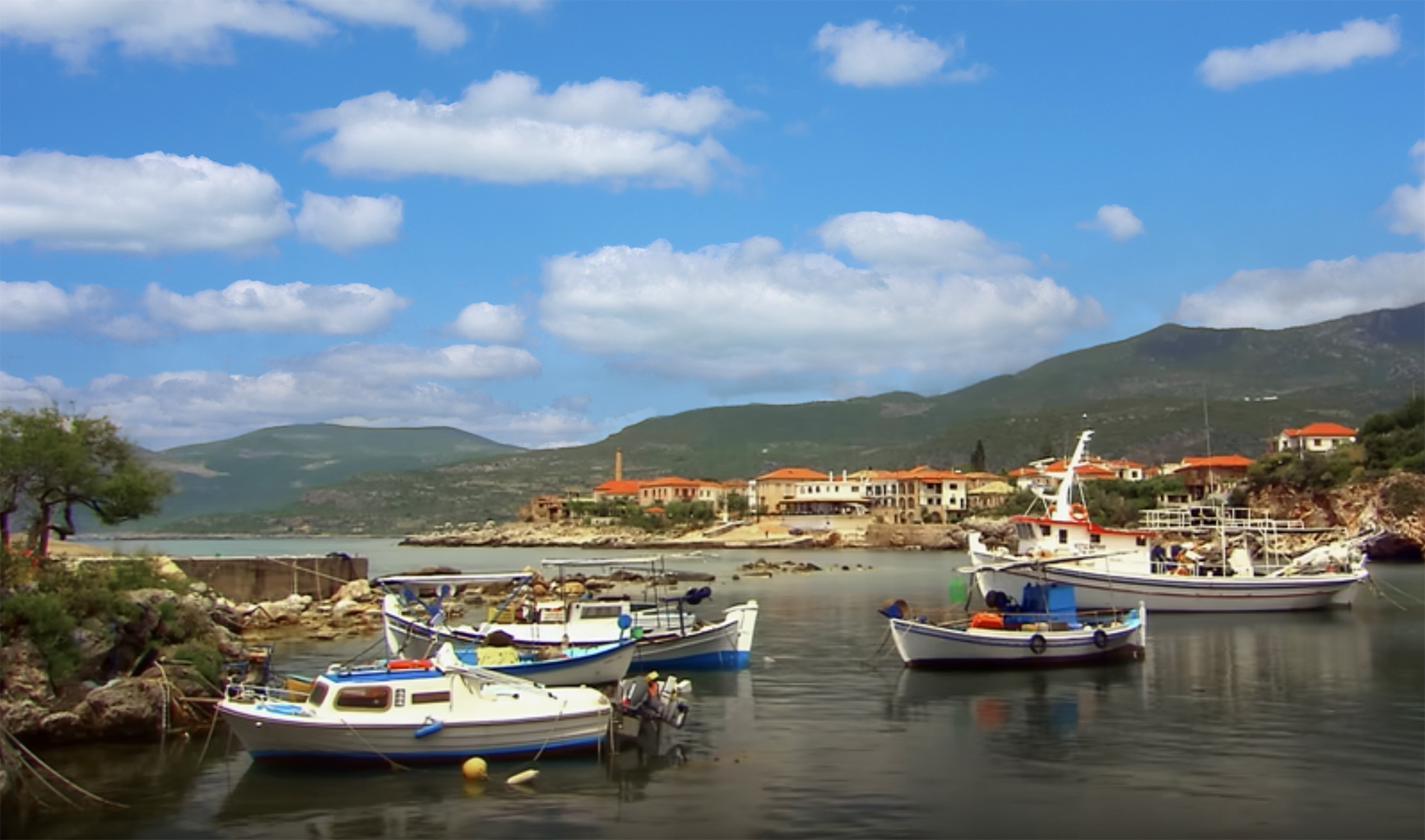
TRAVEL TUESDAY 382 - KARDAMILI, GREECE

“Every rock and stream is a myth.” ― Patrick Leigh Fermor

Welcome to the Travel Tuesday meme! Join me every Tuesday and showcase your creativity in photography, painting and drawing, music, poetry, creative writing or a plain old natter about Travel.
There is only one simple rule: Link your own creative work about some aspect of travel and share it with the rest of us. Please use this meme for your creative endeavours only.
Do not use this meme to advertise your products or services as any links or comments by advertisers will be removed immediately.
Kardamili (Greek: Καρδαμύλη, variously transliterated as Kardamyle, Cardamyle, Kardhamili, and Kardamyli, and sometimes called "Skardamoula", especially on old maps) is a town by the sea thirty-five kilometres southeast of Kalamata, Greece. It is the seat of the municipality of Lefktro in the region of Messenia on the Mani Peninsula. In the Iliad (Book 9), Homer cites Kardamili as one of the seven cities offered by Agamemnon to Achilles as a condition to rejoin the fight during the Trojan War. The village preserves its ancient name.
The area is filled with beaches: Ritsa, Belogianni, Salio, Tikla, Amoni, Santava. The older town includes a mediaeval castle and outworks, and the imposing church of Saint Spyridon. Many of the buildings of Old Kardamili, also known as Pano Kardamili, or "Upper Kardamili" were built by the Venetians and feature a mix of traditional Greek and Venetian design. The skyline of Kardamyli, like many other Maniot towns and villages, is dominated by the distinctive regional architectural of the various towers built by scions of the Nikliani clans, the mediaeval aristocracy of the Mani.
Kardamili is the departure point of many mountain trails, some of which lead to the peak of Mount Taygetus. Kardamili is known in the area for having an especially good view of Mount Taygetus, known locally as Profitis Ilias, literally translating to "Prophet Elijah". Nearby is the Viros Gorge, with a total length of 20 km. The Viros Gorge remains bone dry in summer, however it is known to flood heavily in winter, when snow melts on the mountains and rain falls in heavy downpours. Further afield, one may visit the towns of Oitylo, Areopoli and the Diros caverns.

You are invited to the Inlinkz link party!

Click here to enter

Tuesday, 7 March 2023

TRAVEL TUESDAY 381 - SAMOTHRACE, GREECE

“Greece is the home of the gods. They may have died, but their presence still makes itself felt.” - Henry Miller

Welcome to the Travel Tuesday meme! Join me every Tuesday and showcase your creativity in photography, painting and drawing, music, poetry, creative writing or a plain old natter about Travel.
There is only one simple rule: Link your own creative work about some aspect of travel and share it with the rest of us. Please use this meme for your creative endeavours only.
Do not use this meme to advertise your products or services as any links or comments by advertisers will be removed immediately.
Samothrace (also known as Samothraki; Greek: Σαμοθράκη) is a Greek island in the northern Aegean Sea. It is a municipality within the Evros regional unit of Thrace. The island is 17 km long and is 178 km2 in size and has a population of 2,859 (2011 census). Its main industries are fishing and tourism. Resources on the island include granite and basalt.

Samothrace is one of the most rugged Greek islands, with Mt. Saos and its highest peak Fengari rising to 1,611 m. The famous “Winged Victory of Samothrace”, which is now displayed at the Louvre in Paris, originates from the island.

The Samothrace Temple Complex, known as the Sanctuary of the Great Gods (Modern Greek: Ιερό των Μεγάλων Θεών - Ieró ton Megálon Theón), is one of the principal Pan-Hellenic religious sanctuaries, located on the island of Samothrace within the larger Thrace. Built immediately to the west of the ramparts of the city of Samothrace, it was nonetheless independent, as attested to by the dispatch of city ambassadors during festivals. It was celebrated throughout Ancient Greece for its Mystery religion.

Numerous famous people were initiates, including the historian Herodotus, one of very few authors to have left behind a few clues to the nature of the mysteries, the Spartan leader Lysander, and numerous Athenians. The temple complex is mentioned by Plato and Aristophanes.

During the Hellenistic period, after the investiture of Phillip II, it formed a Macedonian national sanctuary where the successors to Alexander the Great vied to outdo each other's munificence. It remained an important religious site throughout the Roman period. Hadrian visited, and Varro described the mysteries. The cult fades from history towards the end of Late Antiquity, when the temple would have been closed during the persecution of pagans in the late Roman Empire.

You are invited to the Inlinkz link party!

Click here to enter

Tuesday, 28 February 2023

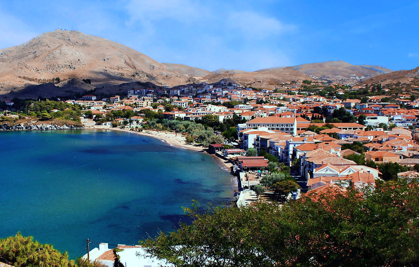
TRAVEL TUESDAY 380 - LEMNOS GREECE

"For the wise it is easy to go anywhere. Because the whole world is home for a good soul." – Democritus

Welcome to the Travel Tuesday meme! Join me every Tuesday and showcase your creativity in photography, painting and drawing, music, poetry, creative writing or a plain old natter about Travel.
There is only one simple rule: Link your own creative work about some aspect of travel and share it with the rest of us. Please use this meme for your creative endeavours only.
Do not use this meme to advertise your products or services as any links or comments by advertisers will be removed immediately.
Lemnos or Limnos (Greek: Λήμνος; Ancient Greek: Λῆμνος) is a Greek island in the northern Aegean Sea. Administratively the island forms a separate municipality within the Lemnos regional unit, which is part of the North Aegean region. The principal town of the island and seat of the municipality is Myrina. At 477.583 square kilometres, it is the 8th-largest island of Greece.
Lemnos is primarily a flat island, but the western region, particularly the northwest, is rocky and mountainous. At 430 meters above sea level, Mount Skopia is the highest point. The chief towns are Myrina, on the western coast, and Moudros on the eastern shore of a large bay in the middle of the island. Myrina (also called Kastro, meaning “castle”) possesses a good harbour. It is the seat of all trade carried on with the mainland. The hillsides afford pasture for sheep, and Lemnos has a strong husbandry tradition, being famous for its Kalathaki Limnou (PDO), a cheese made from sheep and goat milk and melipasto cheese, and for its yogurt.
Fruit and vegetables that grow on the island include almonds, figs, melons, watermelons, tomatoes, pumpkins and olives. The main crops are wheat, barley, sesame; in fact, Lemnos was Constantinople’s granary after the Byzantine Empire lost its Anatolian possessions in the 1320s. Lemnos also produces honey (from thyme-fed bees), but, as is the case with most products of a local nature in Greece, the produced quantities are little more than simply sufficient for the local market. Muscat grapes are grown widely, and are used to produce an unusual table wine that is dry yet has a strong Muscat flavour. Since 1985 the variety and quality of Lemnos wines have increased greatly. Lemnos also has a 7-hectare desert, the Pachies Ammoudies of Lemnos.

You are invited to the Inlinkz link party!

Click here to enter

Tuesday, 21 February 2023

TRAVEL TUESDAY 379 - PERUGIA, ITALY

“A man who has not been in Italy, is always conscious of an inferiority.” - Samuel Johnson

Welcome to the Travel Tuesday meme! Join me every Tuesday and showcase your creativity in photography, painting and drawing, music, poetry, creative writing or a plain old natter about Travel.
There is only one simple rule: Link your own creative work about some aspect of travel and share it with the rest of us. Please use this meme for your creative endeavours only.
Do not use this meme to advertise your products or services as any links or comments by advertisers will be removed immediately.
Perugia is the capital city of Umbria in central Italy, crossed by the River Tiber, and of the province of Perugia. The city is located about 164 km north of Rome and 148 km southeast of Florence. It covers a high hilltop and part of the valleys around the area. The region of Umbria is bordered by Tuscany, Lazio, and Marche. 
The history of Perugia goes back to the Etruscan period; Perugia was one of the main Etruscan cities. The city is also known as the universities town, with the University of Perugia founded in 1308 (about 34,000 students), the University for Foreigners (5,000 students), and some smaller colleges such as the Academy of Fine Arts "Pietro Vannucci" (Italian: Accademia di Belle Arti "Pietro Vannucci") a public athenaeum founded in 1573, the Perugia University Institute of Linguistic Mediation for translators and interpreters, the Music Conservatory of Perugia, founded in 1788, and other institutes.
Perugia is also a well-known cultural and artistic centre of Italy. The city hosts multiple annual festivals and events, e.g., the Eurochocolate Festival (October), the Umbria Jazz Festival (July), and the International Journalism Festival (in April), and is associated with multiple notable people in the arts.

You are invited to the Inlinkz link party!

Click here to enter

Tuesday, 14 February 2023

TRAVEL TUESDAY 378 - SARANDË, ALBANIA

“The wonderful thing about Albania is that not only is it extraordinarily beautiful and provides everything you could want out of a vacation (wonderful seafood, fresh farms, affordability, culture, and history), but it’s also surrounded by a nation of people who are some of the kindest, most welcoming people I’ve ever met.”  - Eliza Dushku

Welcome to the Travel Tuesday meme! Join me every Tuesday and showcase your creativity in photography, painting and drawing, music, poetry, creative writing or a plain old natter about Travel.
There is only one simple rule: Link your own creative work about some aspect of travel and share it with the rest of us. Please use this meme for your creative endeavours only.
Do not use this meme to advertise your products or services as any links or comments by advertisers will be removed immediately.
Sarandë (definite Albanian form: Saranda; Greek: Άγιοι Σαράντα, romanized: Ágioi Saránta) is a city in the Republic of Albania and seat of Sarandë Municipality. Geographically, the city is located on an open sea gulf of the Ionian Sea within the Mediterranean Sea. Stretching along the Albanian Ionian Sea Coast, Sarandë has a Mediterranean climate with over 300 sunny days a year.

Sarandë is known for its blue deep waters of the Mediterranean. Near Sarandë are the remains of the ancient city of Butrint, a UNESCO World Heritage site. In recent years, Sarandë has seen a steady increase in tourists, many of them coming by cruise ship. Visitors are attracted by the natural environment of Sarandë and its archaeological sites. Sarandë is inhabited by a majority of ethnic Albanians, and also has a minority Greek community and as such it has been considered one of the two centres of the Greek minority in Albania.

You are invited to the Inlinkz link party!

Click here to enter

Tuesday, 7 February 2023

TRAVEL TUESDAY 377 - GAZIANTEP, TURKEY

Even with all our technology and the inventions that make modern life so much easier than it once was, it takes just one big natural disaster to wipe all that away and remind us that, here on Earth, we're still at the mercy of nature.” - Neil deGrasse Tyson

Welcome to the Travel Tuesday meme! Join me every Tuesday and showcase your creativity in photography, painting and drawing, music, poetry, creative writing or a plain old natter about Travel.
There is only one simple rule: Link your own creative work about some aspect of travel and share it with the rest of us. Please use this meme for your creative endeavours only.
Do not use this meme to advertise your products or services as any links or comments by advertisers will be removed immediately.
Gaziantep Castle (Turkish: Gaziantep Kalesi) is a castle on top of a mound in the centre of Gaziantep, Turkey. First used as an observation point during the Hittite Empire, it was expanded into a castle during the Roman Empire. The hilltop was first used as an observation point during the period of the Hittite Empire. It was later expanded into a main castle by the Roman Empire in the 2nd and 3rd centuries AD. It underwent further expansion and renovation under Emperor Justinian I between AD 527 and 565. The circumference of the round shaped castle is 1,200 metres. The walls are built of stone and the castle has 12 bastions.
The castle has been renovated numerous times. It saw changes made during the reign of the Ayyubids in the 12th and 13th centuries, as well as the Ottoman Empire, and played an important role during the War of Independence of the early 20th century.
On the 6th of February 2023, a powerful and deadly earthquake struck southern and central Turkey. It is one of the strongest earthquakes ever recorded in Turkish and Syrian history. It occurred 34 km west of the city of Gaziantep at 04:17 TRT (01:17 UTC), causing widespread damage and many fatalities in Southeast Turkey and Northwest Syria. With a maximum Mercalli intensity of IX (Violent) and a magnitude of at least Mww 7.8, the earthquake is tied with the 1939 Erzincan earthquake as the strongest instrumentally recorded earthquake to hit Turkey in modern times, while possibly being surpassed by the 1668 North Anatolia earthquake.
It is also the deadliest earthquake to strike the country since the 1999 İzmit earthquake. The earthquake was followed by numerous aftershocks, the strongest of which had a magnitude of Mww 7.5. This aftershock occurred 9 hours later, 4 km   north–northeast of Elbistan in Kahramanmaraş Province at 13:24 TRT (10:24 UTC). It also had a maximum Mercalli intensity of IX.  As a result of the earthquakes, over 5,000 people were killed and more than 24,000 were injured. Unfortunately, the WHO has predicted that the number of fatalities may increase by a factor of eight as more debris is removed and the true extent of the disaster is realised. Condolences to the families of the victims, and please support the relief effort in any way that you are able to.

You are invited to the Inlinkz link party!

Click here to enter

Tuesday, 31 January 2023

TRAVEL TUESDAY 376 - LIPARI, ITALY

“If your heart is a volcano, how shall you expect flowers to bloom there?” - Khalil Gibran

Welcome to the Travel Tuesday meme! Join me every Tuesday and showcase your creativity in photography, painting and drawing, music, poetry, creative writing or a plain old natter about Travel.
There is only one simple rule: Link your own creative work about some aspect of travel and share it with the rest of us. Please use this meme for your creative endeavours only.
Do not use this meme to advertise your products or services as any links or comments by advertisers will be removed immediately.
Lipari (Sicilian: Lìpari, Latin: Lipara, Ancient Greek: Μελιγουνίς Meligounis or Λιπάρα Lipara) is the largest of the Aeolian Islands in the Tyrrhenian Sea off the northern coast of Sicily, southern Italy; it is also the name of the island's main town and comune, which is administratively part of the Metropolitan City of Messina. Its population is 12,734, but during the May to September tourist season, the total population may reach up to 20,000.
Lipari Island is the largest of a chain of islands in a volcanic archipelago situated in between Vesuvius and Etna. The island has a surface area of 37.6 km2 and is 30 km from Sicily. Besides the main town, most of the year-round population resides in one of the four main villages: Pianoconte is almost due west across the island, Quattropani in the northwest, Acquacalda along the northern coast, whereas Canneto is on the eastern shore north of Lipari town. The highest point on the island is Monte Chirica at 602 m.
The volcanoes of the Aeolian Islands are considered active, and steaming fumaroles and hydrothermal activity may still be seen in their vicinity. As a result of its volcanic origin, Lipari island is covered with pumice and obsidian. Pumice mining has become a large industry on Lipari, and the pale pumice from Lipari is shipped worldwide.

You are invited to the Inlinkz link party!

Click here to enter

Tuesday, 24 January 2023

TRAVEL TUESDAY 375 - SWAN RIVER, PERTH

“No man ever steps in the same river twice, for it's not the same river and he's not the same man.” - Heraclitus

Welcome to the Travel Tuesday meme! Join me every Tuesday and showcase your creativity in photography, painting and drawing, music, poetry, creative writing or a plain old natter about Travel.
There is only one simple rule: Link your own creative work about some aspect of travel and share it with the rest of us. Please use this meme for your creative endeavours only.
Do not use this meme to advertise your products or services as any links or comments by advertisers will be removed immediately.
The Swan River is a river in the south west of Western Australia. Its Aboriginal Noongar name is the Derbarl Yerrigan. The river runs through the metropolitan area of Perth, Western Australia's capital and largest city. This photo is taken from Charles Paterson Park, on the East bank of the river, about 3 km from the CBD.
The river is a significant part of Perth culture, with many water sports such as rowing, sailing, and swimming all occurring in its waters. There have been some north of the river or south of the river distinctions in the Perth metropolitan region over time, especially in the time up to the completion of the Causeway and Narrows bridges, due to the time and distances to cross the river.
The river is the site of the City of Perth Skyworks, a fireworks show held each year on Australia Day, with spectators crowding the foreshore, Kings Park, and on boats on the river to watch the event.

You are invited to the Inlinkz link party!

Click here to enter

Tuesday, 17 January 2023

TRAVEL TUESDAY 374 - GREEK SEA

“We must free ourselves of the hope that the sea will ever rest. We must learn to sail in high winds.” - Aristotle Onassis

Welcome to the Travel Tuesday meme! Join me every Tuesday and showcase your creativity in photography, painting and drawing, music, poetry, creative writing or a plain old natter about Travel.
There is only one simple rule: Link your own creative work about some aspect of travel and share it with the rest of us. Please use this meme for your creative endeavours only.
Do not use this meme to advertise your products or services as any links or comments by advertisers will be removed immediately.
Cape Sounion (Modern Greek: Aκρωτήριο Σούνιο, transliterated Akrotírio Soúnio) is a promontory located 69 kilometres south-southeast of Athens, at the southernmost tip of the Attica peninsula in Greece. Cape Sounion is noted as the site of ruins of an ancient Greek temple of Poseidon, the god of the sea in classical mythology. The remains are perched on the headland, surrounded on three sides by the sea. The ruins bear the deeply engraved name of English Romantic poet Lord Byron (1788–1823).

The site is a popular day-excursion for tourists from Athens, with the sunset over the Aegean Sea, as viewed from the ruins, a sought-after spectacle. The sea and the Greeks have a strong bond from ancient times and this is no wonder, for anywhere you are in Greece, the farthest from the sea that you can be is just 85 miles away (approx. 135 km).

You are invited to the Inlinkz link party!

Click here to enter